How Erosion and Deposition Shape Landscapes
Erosion and deposition are fundamental geological processes that continuously reshape our planet’s surface, creating the diverse and stunning landscapes we see today. Understanding how these forces interact is key to appreciating the dynamic nature of Earth and how features like mountains, valleys, and coastlines are formed and altered over geological timescales. This post breaks down these essential processes, their mechanisms, and the iconic landforms they sculpt.
Simply put, erosion is the wearing away and removal of rock and soil by natural agents like water, wind, ice, and gravity, while deposition is the subsequent settling and accumulation of this eroded material in new locations, thereby building up landforms.
Key Takeaways
- Erosion and deposition are two interconnected processes that sculpt Earth’s surface.
- Agents of erosion include water, wind, ice, and gravity, each leaving unique landforms.
- Deposition builds new landforms from transported sediment, such as deltas and dunes.
- Understanding these processes helps predict landscape changes and manage geological hazards.
What is Erosion? The Unseen Sculptor
Erosion is the process by which earth materials, such as soil, rock, and sediment, are detached from their original location and transported elsewhere. It’s a natural consequence of exposure to the elements and the forces of nature. Think of it as Earth’s constant exfoliation, a gradual wearing down of its surface.
The primary drivers of erosion are water, wind, ice (in the form of glaciers), and gravity. Each of these agents acts differently, carving unique features into the landscape. The rate and type of erosion depend heavily on factors like climate, topography, and the type of rock or soil present.
For instance, a region with high rainfall and steep slopes will experience significant water erosion, leading to deep valleys and canyons. Conversely, arid regions with strong winds often exhibit wind erosion, shaping rocks into abstract forms and transporting sand over vast distances.
Types of Erosion by Agent
- Water Erosion: The most widespread form, occurring through rainfall runoff, rivers, streams, and ocean waves. It can manifest as sheet erosion, rill erosion, gully erosion, and coastal erosion.
- Wind Erosion: Dominant in arid and semi-arid regions, it involves the detachment and transport of loose particles by wind. This can lead to sand dunes, desert pavement, and deflation hollows.
- Glacial Erosion: Carried out by moving glaciers, which are massive bodies of ice. Glaciers can carve U-shaped valleys, cirques, fjords, and deposit moraines.
- Gravitational Erosion (Mass Wasting): The downslope movement of rock and soil due to gravity. This includes landslides, rockfalls, mudflows, and creep.
Mechanisms of Detachment and Transport
Erosion begins with the detachment of particles. Water dislodges soil particles through splashing and runoff. Wind lifts and carries smaller particles.
Glaciers pluck rocks from the bedrock and grind them together. Gravity pulls loose material downhill.
Once detached, these particles are transported. Rivers carry sediment downstream, wind blows sand and dust, glaciers move vast amounts of debris, and gravity causes materials to tumble or slide.
What is Deposition? The Landscape Builder
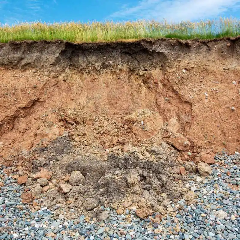
Deposition is the geological process in which agents of erosion—water, wind, ice, and gravity—lose their energy and drop their sediment load. This process is the constructive counterpart to erosion’s destructive power, building up new landforms and altering existing ones.
The principle behind deposition is simple: when an erosional agent slows down or its carrying capacity decreases, it can no longer hold the sediment it’s transporting. This leads to the material being dropped and accumulating. The size, shape, and sorting of deposited sediments provide clues about the depositional environment.
For example, a fast-flowing river carries larger, heavier rocks and sediment. As it enters a slower-moving body of water, like a lake or the ocean, its speed decreases, and it drops these heavier materials first, forming a delta. Finer particles are carried further and deposited in calmer waters or areas with less wind energy.
Forms of Deposition
- Alluvial Deposits: Sediments deposited by rivers, forming features like floodplains, terraces, deltas, and alluvial fans.
- Eolian Deposits: Sediments transported and deposited by wind. This includes sand dunes, loess (fine silt deposits), and sand sheets.
- Glacial Deposits (Till): Unsorted material deposited directly by glacial ice. This can form moraines, drumlins, and eskers.
- Marine and Lacustrine Deposits: Sediments deposited in oceans, seas, or lakes, forming features like beaches, offshore bars, and lakebed sediments.
Factors Influencing Deposition
Several factors control where and how deposition occurs. The energy of the transporting agent is paramount; lower energy means more deposition. The gradient of the land also plays a role; steeper slopes allow for faster transport, while flatter areas encourage settling.
The type of sediment available, its size and density, and the presence of obstacles or changes in the environment (like a river meeting the sea) all influence the depositional process and the resulting landforms.
How Water Shapes the Land: Rivers, Oceans, and More
Water is arguably the most powerful and ubiquitous agent of erosion and deposition. From the mighty Mississippi to gentle streams, rivers carve valleys, transport vast amounts of sediment, and build extensive deltas. Coastal areas are also constantly reshaped by wave action, tides, and currents.
The erosive power of water is evident in the Grand Canyon, a testament to millions of years of riverine erosion. Rivers cut downward, widening their valleys and transporting sediment downstream. As the gradient decreases or the river enters a larger body of water, deposition occurs, creating fertile floodplains and expansive deltas.
Oceans and seas exhibit their own forms of erosion and deposition. Waves crash against coastlines, eroding cliffs and beaches. Longshore currents transport sand along the shore, building spits and sandbars.
In quieter marine environments, fine sediments settle on the seabed, forming layers that can eventually become sedimentary rock.
River Landforms
| Landform | Formation Process | Description |
|---|---|---|
| Canyon | Vertical erosion by a river | Deep, steep-sided valley carved by a river. |
| Meander | Lateral erosion and deposition by a river | Sinuous, curved channel in a river’s course. |
| Delta | Deposition of sediment at a river mouth | Fan-shaped deposit of sediment where a river enters a larger body of water. |
| Floodplain | Deposition of sediment during floods | Flat area of land bordering a river, built up by sediment deposition. |
Rivers are master sculptors, creating a variety of landforms through continuous erosion and deposition.
Coastal Landforms
- Cliffs: Formed by wave erosion undercutting rock, leading to collapses.
- Beaches: Created by the deposition of sand and pebbles transported by waves and currents.
- Spits and Bars: Elongated deposits of sand formed by longshore drift.
- Sea Caves and Arches: Features carved by wave erosion, often leading to stack formation.
Warning: Coastal erosion is a growing concern due to rising sea levels and increased storm intensity, threatening coastal communities and ecosystems.
The Power of Wind: Sculpting Deserts and Plains
In arid and semi-arid regions, wind becomes a significant force of erosion and deposition. Unlike water, wind can lift very fine particles like dust and silt over vast distances, while stronger winds can also roll and saltate (hop) larger sand grains.
Wind erosion, often called eolian erosion, can sculpt rock formations into unique shapes, a process known as abrasion or sandblasting. It also deflates landscapes by removing loose fine material, leaving behind larger pebbles and rocks (desert pavement).
The depositional side of wind action is most famously seen in sand dunes. As wind encounters obstacles or loses energy, it drops its sand load, creating diverse dune formations like barchans, transverse dunes, and star dunes. In areas with abundant fine silt, wind can deposit this material to form extensive, fertile plains known as loess deposits.
Wind Erosion Features
- Yardangs: Elongated, streamlined ridges carved by wind abrasion, typically found in deserts.
- Ventifacts: Rocks shaped and polished by wind-blown sand.
- Deflation Hollows: Depressions formed when wind removes loose particles from the ground surface.
Wind Deposition Features
- Sand Dunes: Accumulations of sand shaped by wind, with various forms depending on wind direction and sand supply.
- Loess Deposits: Thick accumulations of fine, wind-blown silt, often forming very fertile soils.
- Sand Sheets: Extensive, relatively flat expanses of sand deposited by wind.
Tip: Vegetation plays a crucial role in stabilizing soils and preventing wind erosion, which is why planting trees and ground cover is vital in arid regions.
Glaciers: The Slow-Moving Giants of Erosion
Glaciers, immense rivers of ice, are powerful agents of both erosion and deposition. Their sheer mass and movement can dramatically reshape landscapes over long periods. Glacial erosion is a two-part process: plucking and abrasion.
Plucking occurs when meltwater freezes in cracks in the bedrock beneath the glacier, then expands, dislodging rock fragments. Abrasion happens as these embedded rock fragments grind against the bedrock, like sandpaper, carving and smoothing the surface. This process is responsible for creating distinctive glacial landforms.
When glaciers melt and retreat, they leave behind a considerable amount of transported debris, known as glacial till. This unsorted material is deposited in various forms, marking the path and terminus of the ice. These deposits can create fertile agricultural land but also present challenges for infrastructure development.
Glacial Erosional Landforms
- Cirque: A bowl-shaped hollow carved by a glacier at the head of a valley.
- Arete: A sharp, narrow ridge formed between two cirques or glacial valleys.
- Horns: Sharp, pyramid-shaped peaks formed by the erosional action of glaciers on multiple sides.
- U-Shaped Valleys: Broad, steep-sided valleys with a flat floor, characteristic of glacial action.
- Fjords: Deep, narrow inlets of the sea, often with steep sides, formed by drowned glacial valleys.
Glacial Depositional Landforms (Moraines)
Moraines are ridges or mounds of glacial till deposited by a moving glacier. They are named based on their location relative to the ice.
| Moraine Type | Formation | Description |
|---|---|---|
| Terminal Moraine | Marks the furthest extent of glacial advance | Ridge of till at the edge of the glacier. |
| Lateral Moraine | Forms along the sides of a valley glacier | Ridges of till on the valley floor, parallel to the glacier’s sides. |
| Medial Moraine | Formed when two glaciers merge | Ridge of till running down the center of a combined glacial valley. |
| Ground Moraine | Deposited as the glacier melts and retreats | An uneven sheet of till covering the landscape. |
Moraines are clear indicators of past glacial activity and the extent of ice cover.
The Subtle Power of Gravity: Mass Wasting
Gravity is a constant force that, when combined with other factors, drives mass wasting or gravitational erosion. This is the downslope movement of rock, soil, and debris under the direct influence of gravity. While not always as dramatic as a massive landslide, the cumulative effect of mass wasting is significant in shaping slopes and valleys.
Factors that can trigger or accelerate mass wasting include steep slopes, heavy rainfall (which saturates soil, making it heavier and less cohesive), earthquakes, volcanic activity, and human alteration of slopes. The material involved can range from fine soil to large boulders.
Deposition from mass wasting can be quite dramatic, forming talus slopes at the base of cliffs (rockfalls) or thick layers of debris at the foot of landslides. In slower forms of mass wasting, like soil creep, fine layers of soil are gradually moved downslope, often causing subtle but noticeable tilting of trees, fences, and other objects over time.
Types of Mass Wasting
- Rockfalls: Rapid free-fall of rock fragments from a steep cliff or slope.
- Landslides: The sudden, rapid movement of a large mass of rock and soil down a slope.
- Mudflows (Debris Flows): Rapid flow of water-saturated earth material, often occurring in mountainous areas after heavy rain or snowmelt.
- Slumps: Rotational movement of a block of soil or rock along a curved surface.
- Creep: Slow, gradual downslope movement of soil or regolith.
Deposition from Mass Wasting
The material deposited by mass wasting events can create distinct landforms:
- Talus Slopes: Accumulations of rock fragments at the base of a cliff.
- Alluvial Fans: Fan-shaped deposits formed where streams carrying sediment emerge from steep mountain valleys onto flatter ground. (While often associated with rivers, the initial transport can be gravity-driven.)
- Landslide Deposits: Irregular mounds and hummocks of debris left after a landslide.
Important: Understanding the risk of mass wasting is crucial for construction and land-use planning in mountainous or hilly regions. Geological surveys can identify areas prone to landslides.
The Interplay Between Erosion and Deposition
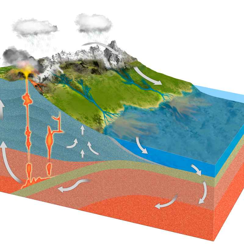
It’s crucial to remember that erosion and deposition are not separate, isolated events but rather continuous, interconnected processes. One cannot occur without the other, and they work in tandem to shape Earth’s surface. Erosion breaks down existing landforms, and deposition builds new ones from the resulting debris.
The landscape is in a constant state of flux. A river system, for instance, erodes its headwaters, transporting sediment downstream. This sediment is then deposited in the middle and lower reaches, building floodplains and deltas, which can then be further eroded by the river’s changing course or by coastal processes if they reach the sea.
The balance between erosion and deposition determines whether a landscape is generally building up or wearing down. In tectonically active regions, uplift can counteract erosion, leading to dramatic mountain ranges. In stable, low-lying areas, deposition can dominate, leading to the accumulation of thick sediment layers.
Dynamic Landscape Examples
- Volcanic Islands: Formed by volcanic activity (deposition), they are then subject to erosion by waves, wind, and rain, eventually shaping their form.
- River Valleys: Rivers erode V-shaped valleys but also deposit sediment along their banks, creating wider floodplains over time.
- Deserts: While wind erodes rock and creates sculpted features, it simultaneously deposits sand to form extensive dunes.
The Geologic Record
The rocks that form our planet are a direct record of these processes. Sedimentary rocks, like sandstone, shale, and limestone, are formed from the deposition and lithification (compaction and cementation) of sediments that were eroded from pre-existing rocks. Fossils preserved within these rocks tell us about ancient environments shaped by erosion and deposition.
Studying these rock layers allows geologists to reconstruct past landscapes and environments, understand historical climate patterns, and even identify periods of significant geological upheaval. The strata are a storybook of Earth’s dynamic history.
Frequently Asked Questions
What is the difference between erosion and weathering?
Weathering is the process of breaking down rocks and minerals in place, without movement. Erosion, on the other hand, is the subsequent movement of the weathered material from its original location by agents like water, wind, or ice. Weathering weakens the material, making it easier for erosion to transport it.
Can erosion and deposition happen at the same time?
Yes, they often happen concurrently. For example, a river is constantly eroding its banks and bed while simultaneously depositing sediment along its course and at its mouth. Similarly, wind can erode sand from one dune while depositing it to build another.
Which is a stronger force: erosion or deposition?
Neither is inherently “stronger” as they are complementary processes. Erosion breaks down; deposition builds up. Their relative dominance in a particular area depends on the prevailing geological and environmental conditions, such as the type of rock, climate, tectonic activity, and the energy of the erosional agents.
How do human activities impact erosion and deposition?
Human activities can significantly alter the rates and patterns of erosion and deposition. Deforestation, agriculture, urbanization, and construction can increase erosion by removing protective vegetation and disturbing soil. Conversely, dam construction can trap sediment, leading to reduced deposition downstream and coastal erosion.
Are all landscapes shaped by erosion and deposition?
Essentially, yes. While tectonic forces create the initial relief (uplift, rifting), erosion and deposition are the primary sculptors that modify these landforms over time, creating the vast diversity of landscapes we observe, from towering mountains to vast plains and intricate coastlines.
Final Thoughts
Erosion and deposition are the ceaseless sculptors of our world, working tirelessly to transform Earth’s surface. From the grandest canyons carved by rivers to the delicate patterns of sand dunes shaped by wind, these processes are responsible for the breathtaking variety of landscapes we inhabit. By understanding their mechanisms and interplay, we gain a deeper appreciation for the dynamic, ever-changing nature of our planet and the geological forces that continue to shape it.